Showing posts with label Adamus. Show all posts

Monday, November 26, 2012

Their Finger Is On The Button

As we approach the final hearings on the CAO (tomorrow 10:45 am), I feel it is an appropriate time to reacquaint ourselves with our vision statement from our Comprehensive Plan. As was noted in a comment to an earlier post, the preamble says:
WE THE PEOPLE of San Juan County recognize that these rural islands are an extraordinary treasure of natural beauty and abundance, and that independence, privacy and personal freedom are values prized by islanders. Being a diverse people bound together by these shared values, we declare our commitment to work towards this vision of the San Juan Islands in 2020 A.D.
The rest is pretty good too. Read it at this link, and judge for yourself whether we are living up to our common vision.

After you do that, reflect on the miserable quality of the scientific deliberations for the CAOs. Reflect on the baseless, blind ambition to invade islanders' privacy. Reflect on what the CAO restrictions will do to our sustainability, our self-reliance, our independence, and our personal freedom.

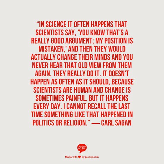
One of my favorite Facebook pages goes by the enthusiastic but somewhat improper name of "I Fucking Love Science", which is often abbreviated IFLS. I'll leave you with some of the posters and cartoons from IFLS that have particular resonance with the CAOs.

Okay, this last one is from the Economist, not IFLS.  We may not be Greece exactly, but have you seen the County's debt or the growth of its expenditures while we have frittered away time on the CAOs?

Tuesday, November 20, 2012

Iceberg Government

Who runs this County? Is it the people we elect? Sometimes it's hard to tell.

Many of the posts on this blog present evidence of how this County operates. We've shown emails of public officials and contractors conspiring to avoid public participation. We've seen State officials tell whopping lies. We have accounts from former citizen-committee members about being led around by the nose by staff and consultants.  We've watched consultants dodge questions and ignore evidence contradictory to their recommendations. We continue to hear double-talk, such as the State contending it has no authority over the CAOs yet the Council uses them as a scare tactic. Latest case in point, we currently hear some existing Council members saying that they have to pass the CAOs otherwise the State will slap a building moratorium on us.

A building moratorium? For what? As a penalty for all the horrible pollution here?

Threats. Sometimes our government seems to be nothing more than a network of bullies insisting that the public be ignored. Along those lines, the latest veiled threat from the Friends came out in the past few days. You can read Kyle Loring's buzzword-laden diatribe here, which combines several environmental themes shotgun style in an effort to strike a chord with the public on something ... anything. Having trouble getting traction on your CAO position?  Mix in a little coal outrage and re-launch.

Let's look at one of Loring's CAO comments:
San Juan County is on the verge of adopting one of the weakest critical areas ordinances in the Puget Sound region. The ordinance’s buffers are designed to allow 40 percent of all local pollution into our streams, lakes, and seas.
This is akin to saying we have the weakest air pollution laws in the region because 100% of our air is allowed to flow unfiltered into our lungs and homes. It's like saying that we have the weakest food laws in the region because we are allowed to eat 100% of the produce from our gardens. We have some of the weakest standards for public responsibility in the region because we let our grant-funded local environmental non-profits baldly misinform and conspire against us.

When our local smoking-gunners can't rely on authenticated facts or sound logic, they rely on their network to back them up. That brings us to "iceberg government," which is the term I've coined for the unseen people and organizations who really wield power here. They drown out and "out-consensus" the views that conflict with their bureaucratic self-interests. They freeze out the public good.

As a summa graduate of Bowdoin, Loring might claim some familiarity with icebergs (Bowdoin alums are known as "polar bears"), and he might even claim some experience with environmental truth. Here's a clip from Bowdoin's Kent Island Research Station from 1998.
Kyle Loring ('98) conducted an experiment to test whether false eye-spots taped to the back of a hard hat truly deter Herring Gulls from dive-bombing. To my surprise, after exposing himself to daily systematic walks through the gull colony, he found no difference in the frequency of attacks or the number of direct hits with or without eye-spots -- it appears that we may have been fooling ourselves into thinking that the eye-spots conferred some protection. He did document, however, that most attacks come from behind (60%) or the side (35%) vs. the front.
Maybe his research gave Loring insight into how to conduct attacks regarding the CAOs (i.e., approach issues obliquely, from behind or from the side, not head on), but I prefer to think that it might offer a clue as to why Loring's arguments customarily lack cogency (too many blows to the head?).
____________________________________________________


Thursday, November 8, 2012

I'll Agree with the "Lame" Part

Nick Power has a very worthwhile perspective on the status of CAOs relative to the election results. It's a good read.

The last blogpost suggested that the elections were a repudiation of all things County. As Nick Power points out, the overwhelming passage of Prop 3 is a strong indicator of public sentiment regarding the CAPR lawsuit against the County ... because that is exactly what the lawsuit is about.

The three Councilors involved in that lawsuit (Pratt, Miller, and Fralick) have had particularly disastrous terms as Council members. Aside from the multitude of troubles Miller has experienced on the CAOs, the solid waste solution (and tax) she promoted went down in scorching defeat last year.

Long ago, Fralick began his term with robust support for his own solid waste fiasco: to set up a needlessly pricey John-Shannon solid-waste wonderland at Beaverton Valley. In the Council vote on that measure, Fralick was the only member to support it to its death. On the CAOs, Fralick has been the main advocate of Adamus as the way forward, which has not worked out particularly well. In addition, Fralick was a strong anti-CRC backer. Right or wrong on those issues, much of what Fralick stood for, politically, is in tatters. His legacy as a retiring Councilman is empty.

Pratt was involved in the Brickworks failure, but more importantly, Pratt seems to share Shireene Hale's view that she's never met a parcel that didn't need more "protection." Moreover, Pratt also seems to have never met a tax and spending proposal she didn't like either. Put those two tendencies together, and you end up with faux environmentalism that is utterly detached from economic reality. That pretty well approximates the position of Pratt, who has been an endless fount of vacuous tautologies about the CAOs and their impacts.

Below is the article by Nick Power titled "Lame Ducks" which also can be read in the Guardian.
___________________________________________________________

My head is spinning thinking of what Tuesday’s local election results mean for the future of the Critical Areas Ordinance (CAO), and I fear that we are now at the point of no return where a misstep by the County will lead to untold economic waste.

First, the The Council races.  Simply the defeat of Howie Rosenfeld and Lovel Pratt were in effect a vote of “no confidence” in Howie's and Lovel's support of the proposed CAO.  Here are two self-identified incumbent Democrats, supported by the endorsement of the Democratic Party, in a County which voted 2 to 1 for Obama over Romney, and they both lose.  Telling since both Howie and Lovel have been two of the proponents of the most extreme portions of the revision of the CAO.

Second, the absolute landslide passage of Charter Amendment No. 3 was, a complete repudiation of how the proposed CAO was engineered and drafted  -- largely in secret and without meaningful public comment.  

I fear that the "we're going to pass this thing come hell or high water" mentality which seems to be the mantra of a majority of the Council will be fulfilled, and the fundamentally flawed CAO will become law at the behest of what is now a gaggle of lame ducks.

But it gets worse, much worse.

Because after Flock of Lame Ducks #1 passes the CAO, Flock of Lame Ducks #2, the newly elected short-term County Council, takes over.

Here is where it gets sticky.  Currently there is a very serious lawsuit against the County alleging various substantive and procedural flaws which invalidate the current draft CAO.   Just because Flock #2 is lame, does not mean that they cannot bind the County and settle the suit and enter into a consent judgment with the plaintiff, Citizen's Alliance for Property Rights (CAPR). 

Why would they do that?  Fundamentally, because CAPR's allegations are substantially correct and it would be the right thing to do.  But moreover, imagine that some ducks from Flock #2 want to experience life as a healthy and vigorous duck so they decide to run in this Spring's special election.  Lame-duck-cum-candidate says to himself, “how the heck do I win an election in San Juan County?”  Well, being skeptical of the CAO seemed to work for Bob and Marc, maybe, just maybe, they were onto something.

So here we are, at the last juncture for the current Council to do what is right and to revisit and repair the fundamental flaws in the proposed CAO.  If this opportunity is not taken, the Council has just bought us all some very expensive tickets to Kabuki theater.

Save me the aisle seat.

Monday, September 3, 2012

Countdown To CAOmageddon: Flaw #32 - Critical Buffers

I know I said during the last post that I would discuss economic valuation, but I need to interject a polemic about buffers first, especially now that we are armed with the knowledge of Ecosystem Services. Valuation will be in the next post. For now, I'd like you to consider the following question:

How are "buffer functions" related to "critical areas functions and values?"

If you have no idea, that makes two of us. I think we have lots of company too. There is nothing about it in BAS. No one has ever connected the dots describing how "buffer function" affects "critical area function and values." I suppose that almost goes without saying, given that no one involved in our CAO has even listed the critical areas functions and values that need protecting.

The whole buffer/critical area function topic is a mind-boggling Escher-painting-like tangle. For example, Shireene Hale sized our water quality buffers for pollutant-removal functionality, and then placed a heap of restrictions on buffer use to protect that (and other) buffer functions. But what does any of that have to do with wetland functions? What about the following statement by Dr. Adamus which was also included in the posting for Flaw #27:
For wetlands categorized as Moderate or High Importance, require monitoring of amphibian dispersal movements by a professional herpetologist (amphibian expert) to determine site-specifically which upland areas are being used most of the year, prior to final determination of buffer width and permit issuance. This would be an expensive endeavor.
Adamus is suggesting that buffers may have critical habitat function because of "amphibian dispersal movements." But if a buffer has a critical habitat function, shouldn't it be part of the habitat critical area, not a buffer? And if "amphibian dispersal movements" aren't critical, why is Adamus saying what he's saying? Buffer functionality has gotten completely mish-mashed with critical area functionality, and yet, at the same time, there is no clearly postulated linkage.

Our County has talked a lot about buffer function whereas the legal requirement is to focus on critical areas function (and values), and we don't even have a theory relating one to the other? Haven't we got this turned on its head? Weren't we supposed to identify the functions and values that critical areas provide to us, rather than obsess over the functions that buffers provide to critical areas? By definition, buffers are not critical areas themselves, so their functions and values do not warrant any protection under the GMA, which begs the question of why our proposed buffers are laden with a surfeit of restrictions?

We are not required to protect buffer habitat function. We are not required to protect buffer water purification function. Assuming buffers function at all, we are not required to protect any regulatory, provisioning, supporting, or cultural functions of buffers or their derivative use/nonuse values.

From the Trojan Heron's perspective, the entire topic of "buffer functionality" seems to be a strategy of confusion for the purpose of extending notions of critical areas protections to non-critical areas. The County has been playing fast and loose when engaging in "function" discussions for non-critical areas, like buffers.

Being a buffer skeptic, I've modified the Epicurean Paradox to express my disbelief in god-like buffers.
Are buffers unable to function as claimed?
Then buffers are not omnipotent

Can buffers function unexpectedly, such as increasing nitrogen "pollutants?"
Then buffers may be malevolent

Are buffers really as functional as claimed?
Then whence cometh environmental degradation?

Are buffers neither as functional nor as valuable as claimed?
Then why call them buffers?

Tuesday, August 21, 2012

Countdown To CAOmageddon: Flaw #19 - Frankenscience

Via the CAO process, many of us have become familiar with the word "BAS," and not just because it is the Irish word for "death" and "demise" either. However fitting that coincidence may be, BAS is more widely known in our locale as the acronym that stands for "Best Available Science," which is a CAO requirement per RCW 36.70A.172 and WAC 365-195-915.

Since our County staff had a hard time digesting the thousands of pages of information submitted as BAS, we hired Dr. Paul Adamus to "synthesize" it. Billed as a professor from Oregon State University, in reality he is a "courtesy appointment" which is a term of art for someone with only the loosest of affiliations to the university ... so loose he's never been paid by the university for being a professor, has no research responsibilities, and has never taught a class. That's loose.

That's not the only thing that's loose. In his resume, Dr. Adamus lists pages and pages of "publications," but many of these are simply client deliverables, not academic publications in peer-reviewed journals. "Wetlands Ordinance, Inventory, and Access Analysis.  Town of Kennebunk, Maine" is a typical example.

Dr. Adamus is our County's go-to guy for CAO science. Have a question about wetlands? Let's ask Dr. Adamus. Pollution? Let's ask Dr. Adamus. Risk? Yep, you got it, let's ask Dr. Adamus. Whatever Dr. Adamus says, it must be true. That's the attitude of County staff and the Council.

This is how we ended up with a stormwater flow methdology, the Rational Method, as the basis for our "site specific approach" for wetland buffers. Conceptualized by Shireene Hale, this approach was adopted by Dr. Adamus who perfected it into our buffer calculator. Hale and Adamus both believe it is a predictor of general pollution, even though that it isn't. It estimates stormwater volume.

Another novel and innovative approach taken by the team of Hale and Adamus (and vigorously supported by Janet Alderton of the Friends) is the notion that native vegetation is better at pollutant removal than other types of vegetation. The origin for this claim comes from the TR-55 manual, which like the Rational Method, has nothing to do with pollutant concentrations. It is a technical document about stormwater volume. One of the tables in TR-55 suggests that lawns with bare spots have higher runoff volume than lawns without bare spots. In other words, it shows that bare earth isn't very good at controlling runoff, so the more bare earth there is, the higher the runoff.

Nevertheless, that basic fact (bare earth equals higher runoff) was transmogrified by the technical committee on buffers into something entirely different. Somehow that initial fact about runoff volume was innovatively interpreted to mean that lawns are not as good as other vegetation at controlling pollution. Then, that was further "interpreted" to arrive at the result that native vegetation is best overall. Once there, only a bit more innovation was needed to conclude that buffers must consist of only undisturbed native vegetation.

All that from a table entry in a technical manual that suggests only that we might expect higher runoff from a patchy lawn versus an un-patchy one, and despite the salient fact that, in reality, grasses are some of the best types of vegetation for attenuating particular types of constituents, especially nitrogen.

Of course, if the Council has any questions about the validity or the applicability of the conclusions drawn from BAS, they can always consult with a scientist. Who would they ask? Oh, that's right, they would ask Dr. Adamus.

Asking Dr. Adamus if the methods he and Shireene cobbled together are valid and applicable is a bit like asking Dr. Frankenstein if his monster is pretty, don't you think?


Friday, June 1, 2012

Answers to Questions

Below, Dr. Adamus answers some questions.  What do you think of them?  I find his answers about the Zhang paper particularly interesting. When pressed about statistics at various meetings, Dr. Adamus has declined to answer and has suggested that a statistician should be consulted. But Dr. Adamus' admitted lack of statistical prowess doesn't prevent him from choosing between Mayer and Zhang, which are both statistical studies.

How can someone provide expert advice on a topic encompassing their self-professed ignorance?

He also gives a statistical answer to the question about the accuracy of the wetlands map. According to Dr. Adamus, the maps have a false positive rate of 3.8% but an unknown false negative rate, implying that it could be quite high. The maps "likely omit" many wetlands, he claims. How many? Only those all-knowing "resident wetland experts" know for sure.
________________________________________________________________


1.     Why does upland habitat need to be protected?

The WAC does not limit protection only to wetlands, streams, lakes, and marine habitats.  In WAC 365-190-030(6a), FWHCA’s are defined as:
“areas that serve a critical role in sustaining needed habitats and species for the functional integrity of the ecosystem, and which, if altered, may reduce the likelihood that the species will persist over the long term. These areas may include, but are not limited to, rare or vulnerable ecological systems, communities, and habitat or habitat elements including seasonal ranges, breeding habitat, winter range, and movement corridors; and areas with high relative population density or species richness.”

One scientific reason for protecting upland habitat is that several wetland-dependent species of amphibians and birds require both upland habitats and wetland habitats to complete their life cycle.  Under the Growth Management Act, Counties are required to protect wetland functions.  One wetland function that is specifically mentioned in official guidance is the provision of habitat -- meaning habitat for all species, not just ones listed as threatened or endangered.

2.     Is the forest buffer only necessary to protect conifers? Why do wetland conifers need to be protected, when there are so many conifers in upland (non-wetland) area?

No.  Forested buffers are needed to protect stands consisting of any type of wetland tree from excessive blowdown.  Trees in wetlands need protection even though there are many times more trees in uplands, for the simple reason that wetland trees are more likely to provide essential habitat to animal species that need to live in or very near wetlands.  An example is wood duck, a species which prefers to nest in (or as close as possible) to wetlands.   Counties are required to protect the habitat functions of wetlands, and wetland trees are a major contributor to a wetland’s habitat functions.

3.     How accurate is the “Possible Wetlands” map?

As explained in the Wetlands BAS chapter:
“Of 105 [“possible wetland”] sites visited, there were four where no evidence (vegetative, soils, or hydrology) of wetland conditions was found anywhere on the accessible parcel, indicating either a map error or less likely a recent alteration.  In other words, the County’s new map of “Possible Wetlands” was determined to have a 3.8% commission error.

The rest of the story is that the maps likely omit many wetlands that could not be detected using only aerial photos and LiDAR.  This is particularly true of forested wetlands.  Resident wetland experts have confirmed this.  However, the omission error rate cannot be measured without large expenditures of field time.

4.     Why should the Mayer paper be used to size buffers rather than the Zhang paper?

The Zhang et al. used less than one-fifth of the full spectrum of 45 buffer studies which they might have, either because they weren't aware of some ("didn't do their homework") or because they purposely avoided using some.  Whereas Mayer et al. have ferreted out nearly every nitrate buffer study published up to that point, and objectively included all of them in their analysis.  If anything, the Mayer et al. curve is conservative because it includes a few studies of nitrate removal by wetlands; wetlands usually remove nitrate more effectively than upland buffers, although sometimes with detrimental effects to the wetland.  Also, at both the "lower and upper ends of the curve" for nitrate, Mayer et al. have more data points than Zhang et al. and thus more credibility to the curve.  Most important, the Mayer et al. publication is not only far more inclusive of published studies, it also is more transparent and compliant with standard procedures of academic research and meta-analysis.

Although in theory one could pick through the studies used in the Zhang or Mayer analysis and analyze only the studies that had land uses most similar to those in San Juan County, there are two major problems with doing that:
(1) One cannot assume similarity of land use (e.g., was it a study in an urban or agricultural setting?) is the most important driver of how wide a buffer should be.  Factors such as buffer slope, soils, size of the development, and climate are often much more important, so one would have to determine all of those factors for every study before one could select “just the studies most relevant to San Juan County situations.”
(2) Doing so would require an enormous expenditure of time and money, and would prove fruitless in some cases because many researchers do not report all those background conditions when they write up their results.

5.     With regard to wetlands that don’t have a surface water outlet – if the soils had high conductivity, with good subsurface flow out of the wetland, could they be placed in the Low Water Quality/ Sensitivity category?

In theory, probably yes.  However, determining if the soils had high connectivity and good subsurface flow out of the wetland (a) would require judgment by a qualified professional who visits the wetland at an appropriate time of year, thus requiring landowners to pay for a consultant, and (b) lacks any basis for deciding what constitutes “high” connectivity and “good” subsurface flow.

6.     Jon Cain (legal counsel) would like the definitions of lakeside wetland and large pond wetland refined to be clearer.

            I will need additional guidance as to what is unclear.

“Lakeside wetland” means a wetland that is within or contiguous to and within 100 feet of a ponded water body larger than 20 acres, and whose water levels fluctuate in near synchrony with those of the water body.  This does not include wetlands that develop on non-wetland sites, as may occur when water is impounded with a structure.

“Large pond wetland” means a wetland that is within or contiguous to and within 100 feet of a body of surface water that is between 5 and 20 acres in size and is present for all or most of a normal year; or a wetland which contains patches of standing water that cover between 5 and 20 acres during all or most of a normal year.

Sunday, May 6, 2012

Living Between Their Lines

Fortunately, something that did NOT make it's way into the draft version of the wetlands CAO (just barely) was a requirement for permanently demarcating buffers with signs. Excerpts from some of the emails discussing signs are shown below, and I've included a photo of a CAO sign from Whatcom County.

While we were able to avoid signs in our draft wetlands CAO for now, we nevertheless know where some community members want to take this County.

Do this, don't do that, can't you read the sign? We might as well be a lifelike display at Disneyland or a Potemkin village.
__________________________________________________


--- On Mon, 1/23/12, Scott Rozenbaum <rozewood@rockisland.com> wrote:

From: Scott Rozenbaum <rozewood@rockisland.com>
Subject: Re: permanent markers for buffer boundaries
To: "Paul Adamus" <adamus7@comcast.net>
Cc: "Janice Biletnikoff" <janiceb@sanjuanco.com>, "Ed Kilduff" <ed.kilduff@me.com>, "Janet Alderton" <jmalderton@yahoo.com>, "Shireene Hale" <shireeneh@sanjuanco.com>, "Dan Nickel" <DNickel@watershedco.com>, "Rachel Dietzman" <racheld@sjcpublicworks.org>, "Erik (ECY)Stockdale" <ESTO461@ECY.WA.GOV>, "Anderson Paul (ECY NWRO SEA)" <paan461@ECY.WA.GOV>, "Belluomini Steve" <sbelluomini@yahoo.com>, "TomHruby" <thru461@ECY.WA.GOV>
Date: Monday, January 23, 2012, 3:29 PM
I was off on the prices of the signage.

See excerpt below from King County Wetland regs:

Wetland Not in Tract
Wetland signs and fences may be required by the department.
Sign and fence Requirements
The signs must be placed at the edge of the required buffer, between the buffer and
the 15-foot BSBL. The spacing of the signs will be determined during the review of
the development proposal. Generally signs are spaced every 50 feet to 150 feet and
stationed in a prominent location (i.e. at the closest point to the proposed
development). Signs may be attached to a post or fence. Wetland Areas Boundary
signs are available from the King County Department of Development and
Environmental Services for $2.50. A Stream Sign Installation Detail is available from
DDES.

Scott

On Jan 23, 2012, at 12:36 PM, Paul Adamus wrote:

How about "permanent and obvious..." ?   More than just having a legal record of where the buffer is supposed to be, the purpose of markers is to visually dissuade people and ATVs from overusing the buffer area and thus compacting the soil or unintentionally disturbing wildlife in the wetland.  A survey pin would not accomplish that.

Paul Adamus


From: Janet Alderton [mailto:jmalderton@yahoo.com] 
Sent: Monday, January 23, 2012 10:01 AM
To: Shireene Hale; Scott Rozenbaum; Dan Nickel; Janice Biletnikoff; Rachel Dietzman; Erik (ECY)Stockdale; Anderson Paul (ECY NWRO SEA); Belluomini Steve; Ed Kilduff; Paul Adamus
Cc: TomHruby
Subject: Re: permanent markers for buffer boundaries

Hi everyone,

I know that we are outside of the commenting window, but I have found reference to the marking of buffer boundaries for Kitsap County in WA State. I favor some permanent marking of buffer boundaries.

Regards,
Janet

#07 49708               Brown Reasonable Use Exception Staff Report              6
2. Buffer enhancement shall occur pursuant to the February 10, 2007 buffer enhancement plan prepared by B & A, Inc. Enhancement shall include plantings as specified in the plant list (Table 1), and removal of blackberry plants and fill within the designated buffer area.
3. The final planting schedule and monitoring plan shall be conditions of future building permit approval. Written confirmation of fill removal shall be submitted to Kitsap County DCD, by the applicant’s wetland consultant prior to building permit issuance.
4. A split rail fence shall be installed along the perimeter of the replanted buffer area prior to final occupancy, as indicated on the site plan. Wetland buffer signs (available from the Department) shall be installed at 50 foot intervals along the fence.
cc:           Hearing Examiner Clerk of the Hearing Examiner Kitsap County DCD, Development Engineering Kitsap County DCD Staff Planner: David Greetham DCD File


Friday, May 4, 2012

The Most Important Question Is "Why?"

In the emails below, Shireene has a lot of questions for the authors of the Zhang paper, and she relays to Dr. Adamus the results of a conversation she had with Richard Fralick, Patty Miller, and Pete Rose.

Of all the questions being asked about the CAOs and SMP, I think the most important question has to be, "Why?"  Why is the County conducting itself in this manner? Why can't the citizens of this County hear conversations in the open? Why the secret "science" conversations? Why does Shireene take such a lead on "science", to the point of seeming to influence the answers and implementation? Why the secret CAO Implementation Team meetings? Why the claims of public threats and incivility from the County when there appear to be none. According to sources who have checked on the matter of "threats", not even the sheriff's office knows what "threats" they may be talking about.

Why does our County government act this way?
______________________________________________________________
From: Paul Adamus [mailto:adamus7@comcast.net] 
Sent: Monday, April 16, 2012 7:08 PM
To: Shireene Hale
Subject: Re: Zhang et al. 2010 questions

Thanks, Shireene.  I'm unavailable this week (working in Alberta again) but am willing to communicate with those authors if they, too, are willing.

Paul
 _____  

From: "Shireene Hale" <shireeneh@sanjuanco.com>
To: adamus7@comcast.net
Sent: Monday, April 16, 2012 4:05:32 PM
Subject: Zhang et al. 2010 questions

Paul,

I met with Patty, Richard and Pete this morning. They were not crazy about a conference call with the scientists to discuss the Mayer and Zhang papers (which the Planning Commission recommended). They are however discussing the CAO schedule with the full Council tomorrow. 

They are hoping that you, Dr. Mayer, and Dr. Zhang can perhaps have a conversation about the two papers and provide them an explanation of the merits and draw backs of each approach.

I contacted one of the authors and received this response. The primary author is Xuyang Zhang, and her e-mail address is xzhang@cdpr.ca.gov. See my e-mail below.

If something changes as a result of the Council meeting tomorrow I will let you know.

SH

P.S. It is taking a while for Lynda to complete the minutes from the four Planning Commission meetings. It will probably be later this week before we have a draft with their changes integrated, and probably next week before we have the approval of the Planning Commission officers. 


From: Minghua Zhang [mailto:mhzhang@ucdavis.edu] 
Sent: Monday, April 16, 2012 1:26 PM
To: Xuyang Zhang; Shireene Hale
Subject: Fwd: Zhang et al. 2010 questions

Hello,

I forward this email to the senior author of our paper who reviewed hundreds of papers and put the paper together.  She will know by heart on the work and can better answer your questions without having to re-think about the paper.  So your questions can be better handled.

Xuyang, go ahead and answer these questions.  Thanks.

If you have more questions, feel free to contact me.  Thank you for your interest in our work.  It is pleasing to hear that you may take some of the approaches for management.

Minghua

-------- Original Message -------- 


Subject: 
Zhang et al. 2010 questions
Date: Mon, 16 Apr 2012 13:14:08 -0700
From: Shireene Hale  <mailto:shireeneh@sanjuanco.com> <shireeneh@sanjuanco.com>
To: <mailto:mhzhang@ucdavis.edu> <mhzhang@ucdavis.edu>

Good morning,

I work for San Juan County and we are in the process of reviewing and updating our wetland, stream and shoreline protection regulations to meet Washington State requirements (including the requirement that we consider the best available science and ensure no net loss of the functions and values of these areas). 

As part of this effort we are attempting to develop a site specific approach to sizing wetland and riparian buffers, and of course protection of water quality is an important consideration. At this point our proposed approach for the water quality component of the buffer uses rational method runoff coefficients to predict whether the runoff will be above or below ground, and Figure 1 of Mayer et al. (attached) to determine appropriate buffer sizes for a given percentage of pollutant removal (using nitrogen removal as a proxy for all potential contaminants flowing into the buffer). 

As an alternative, there is now interest in using the paper you co-authored as a guide to appropriate buffer sizes (again, just for the water quality aspects of the buffer), and I have a few questions.

First, it appears your focus was on buffers for agricultural land uses. Did you review any studies of buffers for residential and commercial land uses, where lawns and hardscape (e.g. roads/ driveways, parking areas, roofs, tennis courts etc. ) cause more of the runoff to flow above ground?  Do you think we can apply your results to the runoff and buffers for residential and commercial land uses?

Dr. Mayer's paper presented results based on whether the runoff is above or below ground. That seems important for runoff from residential and commercial areas. If we were to use your paper as a guide, should we assume that figure 3 depicts the situation for runoff that is below ground, and increase the buffers as sites become more impervious and more of the runoff is above ground? 

In comparing the two papers, it looks like the pollutant  removal estimates for nitrogen, with a 10 meter buffer, and runoff mostly below ground, both show a removal efficacy of about 70%. For a 20 meter buffer, your paper shows about 90% removal, while Mayer et al. shows about 75%. Do you have any thoughts on why they are different? 

Finally, would you or another member of the team that worked on your study, perhaps be willing to talk with me, Dr. Mayer, and our consultant, Dr. Paul Adamus, about your results and the use of your paper? I spoke with a portion of our County Council this morning, and they are hoping we can facilitate a dialogue on the use of either or both papers as a guide to the water quality component of our buffer requirements.

Thank you for your time.

Sincerely,

Shireene Hale
Planning Coordinator/ Deputy Director
San Juan County
360.370.7569

shireeneh@sanjuanco.com

Monday, April 23, 2012

Dumb and Dumber

At least one Council member keeps saying that our current buffers are "dumb" because they were established without the benefit of Best Available Science (BAS). In her mind, the "problem" with our current version of the CAOs is that we must revise our buffers to comply with WAC 365-195-900 (RCW 36.70A.172):

Counties and cities must include the "best available science" when developing policies and development regulations to protect the functions and values of critical areas

But the requirement to include BAS in our considerations doesn't automatically mean changing our buffers. Besides, many who have been following our County's BAS and the travails of Dr. Adamus are not at all convinced that the new proposed buffers are any smarter than our current buffers, and they may be a good deal dumber.

The fact is, whatever the official BAS might say, our current buffers are the only buffers we have empirical evidence for, and they appear to have been doing a pretty good job. In that regard, they represent the best, most local, and only proven BAS we have about buffers for our County environment. Who abandons a system that is working for a theoretical, unproven method of protection?

It looks like our County might, that's who.

Saturday, April 21, 2012

Removing All Doubt

For the Planning Commission hearings on the wetlands CAO, hundreds of people showed up dispersed over four days to testify to the Planning Commission or just watch the proceedings. It was a remarkable sight to see so many bright, concerned people from all over these islands participate in our democracy. It was especially wonderful to see the diversity of the people. Gone, at least for the moment, were the days when no one but just a few Friends or government staffers were sprinkled about the gallery while the Commission considered matters in relative obscurity.

But not everyone saw the experience in a positive light. During last week's Council meeting, Shireene Hale, the planner in charge of the proposed CAOs, characterized the Planning Commission meetings immoderately. When speaking about the upcoming schedule for further Planning Commission meetings, she couldn't help but editorialize:

"by May the PC will have recuperated from the 4 awful Planning Commission meetings"

Awful?!? Recuperated? That's how a senior County staffer views us and reacts to the diverse public participation surrounding this crucial topic, arguably one of the most important pieces of land use legislation ever to be considered by this County?

Perhaps Shireene prefers the way things were working last autumn, when she appeared to be making decisions out of public view, in conjunction with the Friends and the State, and then simply informing local officials after the fact, including suggesting what is or is not a scientifically defensible approach.

Judge for yourself. What's closer to your definition of "awful"?
____________________________________________________________________

From: Richard Fralick
Sent: Monday, November 14, 2011 10:31 PM
To: richpeterson@rockisland.com
Cc: Patty Miller
Subject: RE: What the heck is going on?

Hi Rich,

I received a call from Lovel  mid-afternoon today telling me that Paul Adamus threw a monkey wrench into the Planning Commission process on Thursday.  She also told me that Shireene was going to schedule a telecom with various players including Janet Alderton some time soon.  I told Lovel that I felt the process was spinning out of control and that Janet among others had no business being involved at this point in time. I strongly suggested that the Implementation Team needed to meet ASAP to sort things out, even if it meant meeting Thanksgiving Week.  At my insistence we are trying to schedule an Implementation Team Meeting next Monday.

Until your email, I had no idea that the call including Janet had been made as I was not copied on Shireene's email on Saturday.  I share your distress and promise that if it is at all within my power we will sort things out if and when we meet next Monday.  Please bear with me till then.

Richard Fralick  
______________________________

From: richpeterson@rockisland.com [mailto:richpeterson@rockisland.com]
Sent: Mon 11/14/2011 8:24 AM
To: Richard Fralick
Cc: Patty Miller
Subject: What the heck is going on?

I'm sending on a memo Shireene sent to the Planning Commission for your information and to see if either of you have some of the questions I have about this process. Among mine is: What is it about Janet Alderton that gives her special standing enabling her participation in a conference call that ends up changing a staff reccomendation?  Rich


From: Shireene Hale [mailto:shireeneh@sanjuanco.com]
Sent: Saturday, November 12, 2011 1:03 AM
To: Shireene Hale; Lynda Guernsey; Janice Biletnikoff; Amy Vira; barbara thomas; Bob Gamble; Brian Ehrmantraut; Evelyn F Fuchser; John Lackey;john@sanjuanislands.com; Jon Cain; Karin Agosta; Lynda Guernsey; Mike Carlson; steph3339@gmail.com; Susan Dehlendorf
Subject: Update on discussion with scientists

Hello again,

After the Planning Commission hearing we had a conference call that included Dr. Adamus, Erik Stockdale (Ecology), and Janet Alderton. The main purpose of the call was to discuss Dr. Adamus' comments - which came as quite a surprise considering he told us he had reviewed the proposed changes, and he provided comments that were incorporated into the most recent draft. After talking he understood how we got from his prior version of the buffer sizing procedure to the simpler version.

Among other topics of discussion, most if not all of us reached the conclusion that 50% pollutant removal and 15 foot buffers are probably not adequate to protect wetland functions and values from the type of pollutants typically found in residential runoff. For water quality purposes, Dr. Adamus explained that the 15 ft. was based on the removal of coarse sediment (the easiest contaminant to remove) - not the fine sediment and soluable contaminants common in residential runoff.  It would have been great to have sorted that out before now - but better now than later.

In addition, I reached the conclusion that part of our problem in dealing with some of the water factors is that there are at least two important variables, slope and amount of impervious area, that both influence whether runoff is above or below ground and that vary independently, resulting in an array of combinations (both low, one high the other low, both high, and everything in between) that are difficult to show in a table format. (Whether runoff is above or below ground makes a difference because pollutant removal is more effective when the water stays below ground). The discussion with the scientists is continuing and I have proposed that we consider switching gears and using a simple equation to determine the necessary width of the water quality portion of the buffer, based on impervious area, slope and the presence (or absence) of a drainageway. The high and low ends of the buffer spectrum would remain the same (except for the 15 ft. buffers) and the buffers would still be based on the Mayer 2007 paper - there would just be a lot more incremental steps in between the small and larger buffers - which seems like a more scientifically defensible approach.

Anyway, I will keep you posted.

Thanks for your patience - this is not an easy task for any of us.

Shireene Hale, EHS
Planning Coordinator/ Deputy Director
San Juan County Community Development & Planning PO Box 947

Wednesday, April 11, 2012

Why Nitrogen?

At a March 6 meeting of the Planning Commission, Mike Carlson asked Dr. Paul Adamus a simple two-word question, "Why nitrogen?"  Mike was referring to the fact that Dr. Adamus' buffer proposal in the wetlands CAO draft had used nitrogen as a proxy for all other pollutants. Why did Dr. Adamus base all his wetland buffer calculations on nitrogen?

You can watch Dr. Adamus' reply in this clip. Referring to the 2007 Mayer meta-analysis of nitrogen, Dr. Adamus says, "Simply because it's the only published meta-analysis that there is out there. It's Best Available Science, so that's basically why we went with that."

This is not the first time Dr. Adamus has made this claim. Frequently, he has said that there is one and only one published meta-analysis that evaluated the relationship between buffers and pollutants: the Mayer 2007 paper which examined nitrogen.

The troubling aspect to Dr. Adamus' answer is that it is not true, and he apparently knew it wasn't true.  A few weeks after the March 6 meeting, a "new" meta-analysis of buffers with respect to four pollutants came to the public's attention, although it really wasn't such a new paper after all.  The peer-revewed "Zhang paper" had first been published online in 2009 and in print in 2010, old enough to make its way into our County's adopted Best Available Science (BAS).  When confronted with the Zhang paper at the next Planning Commission meeting, Dr. Adamus admitted that he knew of it, knew it was in our BAS, but preferred the Mayer paper, because, he added, Mayer's paper had a larger sample size.

Regardless of his reasons for preferring Mayer over Zhang, it does not explain why Dr. Adamus never mentioned the Zhang paper. Never.  It does not not explain why he repeatedly said there was only one published meta-analysis when he apparently knew that wasn't a true statement.

It turns out, had Dr. Adamus' buffer proposal been based on the Zhang paper instead of the Mayer paper, the resulting proposed buffer calculations might have resulted in smaller buffers.  As a result, I have a new question for Dr. Adamus?

Why hide Zhang?

Tuesday, April 3, 2012

When Is 88 Greater Than 246?

Apologies to my fans for not posting over the last few days.  An accumulation of personal and professional responsibilities diverted my attention. One reader wondered where I had gone. I am here, and I am back with a new CAO riddle.

Question: When is 88 greater than 246?
Answer: When you are discussing Best Available Science for wetlands with a nationally recognized expert.

During the past week, a new controversy arose at our Planning Commission meeting (see previous post) regarding the scientific justification for our buffers. Our County has based its wetland buffer proposal on a paper by Mayer (Mayer et al, 2007). Dr. Paul Adamus, who is an unpaid non-tenured courtesy faculty member at Oregon State, is the "nationally recognized" wetland expert serving as our County consultant. He has been unwavering in his support for the Mayer paper as the basis for our buffer sizes.

One of our local citizens decided to discuss the Mayer paper with Mayer himself. Interestingly, Mayer recommended several other papers that he thought provided equal or greater insight into the workings of buffers.  Mayer also acknowledged that his study had not demonstrated a strong relationship between pollutant removal/retention and buffer width. As Mayer shows in his paper, buffer width explains only about 9% of pollutant removal/retention. Pollutant removal depends 91% on something other than width.

An additional reference recommended by Mayer was a statistical meta-analysis by Zhang, et al., 2009. The Zhang paper is very interesting for several reasons. First, as mentioned, it is a meta-analysis, and we have been told by Dr. Adamus on innumerable occasions that meta-analysis is the best of the best. It's state of the art. It's the kind of analysis performed by epidemiologists. So, the Zhang paper would appear to be in the same category of excellence as the Mayer paper (and remember, Mayer himself is recommending Zhang). Second, the Mayer paper looks at only one pollutant, nitrogen/nitrate, whereas the Zhang paper looks at four: sediment, nitrogen, phosphorous, and pesticides. Third, Dr. Adamus admits that the Zhang paper already is part of the BAS adopted by the County.

One of the major conclusions of the Zhang paper is that buffers, for all practical purposes, have a maximum effective width. At some point, buffer width reaches diminishing returns. Had this principle been incorporated into our County's proposed buffer methodology, we would have ended up with smaller (probably much smaller) proposed buffers. Dr. Adamus acknowledges that he discarded the conclusions of the Zhang paper in favor of the Mayer paper. The question becomes why did Dr. Adamus choose one meta-analysis (Mayer) over another (Zhang)?

The Planning Commission asked Dr. Adamus that question: why Mayer and not Zhang? The answer from Adamus: Mayer used a bigger sample size. Adamus stated this as justification more than once during the Planning Commission meeting.

There are several difficulties with that answer, not the least of which is that it may not be true. The Zhang paper looked at 81 studies for sediment removal, 61 for nitrogen, 52 for phosphorous, and 52 for pesticides. The Mayer study looked at 0 studies for sediment removal, 88 studies for nitrogen, 0 for phosphorous, and 0 for pesticides. If you look at the data across all pollutants, Mayer's sample size was 88 and Zhang's was 246 (81+61+52+52). Mayer's sample size was greater only for nitrogen specifically (88 versus 61). On that basis, Adamus decided to use the Mayer nitrogen results as a proxy for every other pollutant, even though Zhang had actual data for other pollutants.

It's hard to completely fathom Dr. Adamus' answer, and he appears to be suggesting that data quantity trumps data quality too. As a result, not only his conclusion but his entire reasoning about statistical validity may be specious. Data quality and usability are critically important, and there are several acceptance criteria typically employed to evaluate data on those dimensions. They are called the PARCC criteria: precision, accuracy, representativeness, completeness, and comparability. Occasionally, these criteria are supplemented by a sixth criterion, sensitivity.

Sample size, if it has an effect, exerts its influence on these quality criteria, but sample size is not necessarily a worthwhile discriminator in its own right. Did Zhang's smaller nitrogen sample size affect the precision, for example? Actually, for the Zhang paper, the variance of the nitrogen data appears to be smaller than Mayer's, indicating that the Zhang data may be more precise even though it has fewer nitrogen data points than Mayer. Overall, based on a more thorough evaluation of acceptance criteria, Zhang may be the better study to use, even for nitrogen.

Mayer might think so.  That's probably why he recommended it.